
The latest monthly Global Seasonal Climate Update issued by the World Meteorological Organization (WMO) has indicated a clear shift in the Equatorial Pacific, with rapidly rising sea-surface temperatures pointing towards a likely return of El Nino conditions as early as May-July 2026.
The report forecast a “nearly global dominance of above-normal land surface temperatures” over the upcoming three-month period, along with notable regional variations in rainfall distribution across different parts of the world.
“After a period of neutral conditions at the start of the year, climate models are now strongly aligned, and there is high confidence in the onset of El Nino, followed by further intensification in the months that follow,” said Wilfran Moufouma Okia, Chief of Climate Prediction at WMO.
“Models indicate that this may be a strong event, but the so-called spring predictability barrier is a challenge for the certainty of forecasts at this time of year. Forecast confidence generally improves after April,” he added.
El Nino and La Nina are opposite phases of the El Nino-Southern Oscillation (ENSO), one of the most influential climate patterns globally. These events significantly alter weather systems, affecting rainfall, drought conditions, and extreme weather events across continents.
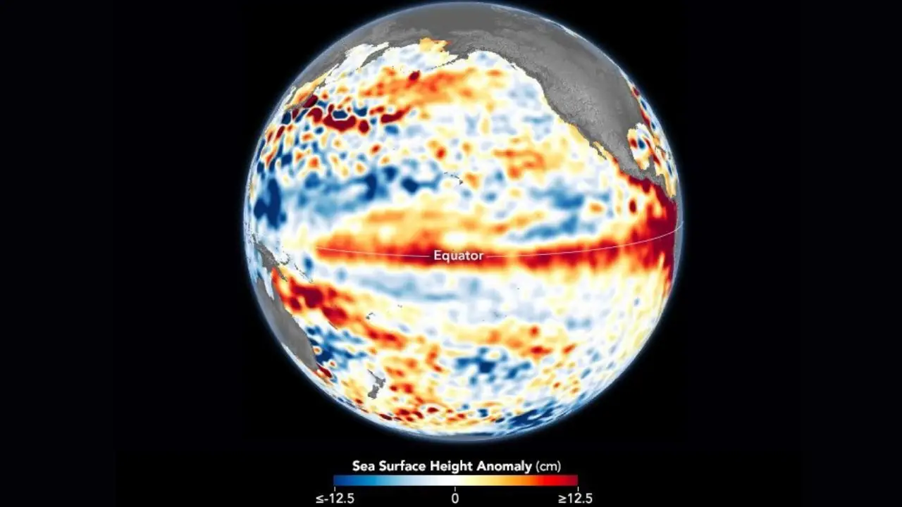
El Nino is marked by the warming of ocean surface temperatures in the central and eastern Equatorial Pacific. It typically occurs every two to seven years and lasts around nine to twelve months. The WMO clarified that it does not use the term “super El Nino,” as it is not part of its standard classification system.
The agency noted that El Nino events generally have a warming impact on global climate patterns. It highlighted that 2024 became the hottest year on record due to the combined effects of the 2023–2024 El Nino and human-induced climate change.
“There is no evidence that climate change increases the frequency or intensity of El Nino events. But it can amplify associated impacts because a warmer ocean and atmosphere increase the availability of energy and moisture for extreme weather events such as heatwaves and heavy rainfall,” the report said.
El Nino conditions are typically associated with increased rainfall in parts of southern South America, the southern United States, the Horn of Africa, and central Asia, while causing drought in Australia, Indonesia, and parts of southern Asia. During the boreal summer, it can also intensify hurricane activity in the central and eastern Pacific while suppressing cyclone formation in the Atlantic basin.
For the May-June-July 2026 season, WMO forecasts indicate that land surface temperatures are expected to be above normal nearly everywhere, with particularly strong signals over southern North America, Central America, the Caribbean, Europe, and Northern Africa. Rainfall projections, however, show strong regional variability.
The report emphasised that seasonal forecasts are critical for preparedness in agriculture, water resource management, energy, and health sectors. WMO is expected to release its next El Nino/La Nina update in late May, offering more refined guidance for the June-August period.
Currently, the ENSO system remains in a neutral phase as of early April 2026, according to global monitoring centres, following the end of the 2025–26 La Nina. However, multiple forecast models suggest a transition towards El Nino conditions during the boreal summer or autumn, potentially continuing through the end of the year.
The WMO also noted that regional climate outlook forums, including the South Asian Climate Outlook Forum, will issue monsoon forecasts on April 28, while a global seasonal briefing for UN and humanitarian agencies is scheduled for April 29, focusing on ENSO and other climate drivers.
Earlier this month, the India Meteorological Department (IMD) indicated that India is likely to experience a below-normal monsoon this year, the first such projection in three years. The IMD said the 2026 southwest monsoon rainfall (June to September) is expected to be between 90–95 per cent of the Long Period Average (LPA), with a central estimate of 92 per cent and a model error margin of ±5 per cent. The LPA, based on 1971–2020 data, stands at 87 cm.
Leave a Reply